A Covered Bridge Safari with the Keatings
CB Travels, Western NY to Blue Ridge, Ga.
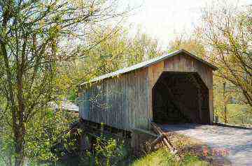 |
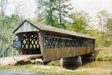
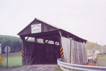
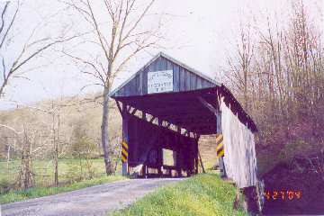
| Walcott Bridge, KY-12-01 |
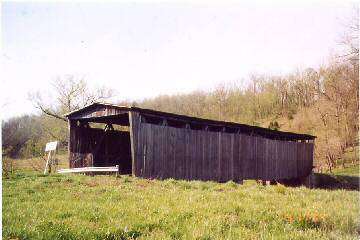 |
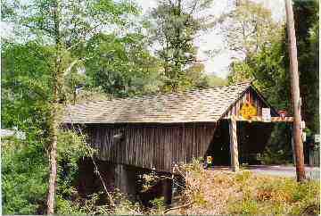
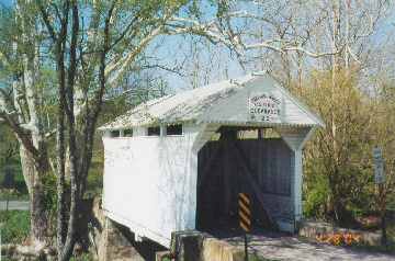
| Dover Bridge KY-81-01 |
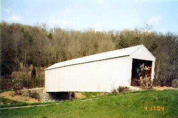 |
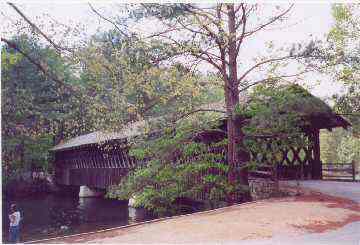
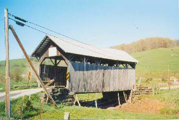
| Johnson Creek Bridge KY-101-01 |
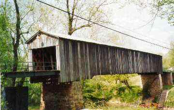 |
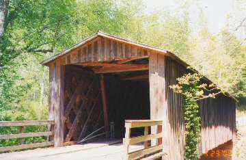
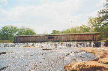
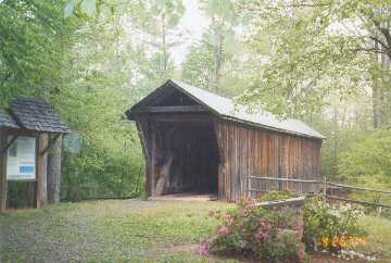
| Euharlee Creek Bridge GA-08-01 |
 |
| Poole's Mill Bridge GA-58-01 |
 |
| Concord Bridge GA-33-02 |
 |
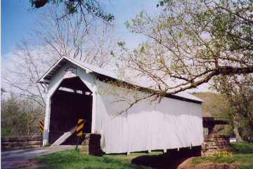
| Stone Mountain Bridge GA-44-01 |
 |
| Lisette at Southeastern RR Museum, Dulth,
Ga |
 |
| Elders Mill Bridge GA-108-01 |
 |
| Watson Mill Bridge GA-97-01 |
 |
| Howard Bridge GA-109-01 |
 |
| Cromer's Mill Bridge GA-59-01 |
 |
| Stovall's Mill Bridge GA-154-03 |
 |
| Campbell's Bridge SC-23-02 |
 |
| Amicalola Falls State Park, GA |
 |
Tallulah Falls State Park, GA
|
Sunday, 2 May 2004
Hi Joe
We left home in western New York state about noon,
on Friday, April 16.
My wife and I baby sit our only grandchild, Julia,
three mornings a week. Although our daughter lined up babysitters while we are gone, she was
unable to find someone for this morning who was trained to perform the specialized therapy that
Julia needs every morning due to her Cystic Fibrosis, an incurable genetic disease. My wife,
Lisette and I are both trained to do this therapy.
We stopped for the night in Medina, Ohio. On
Saturday we headed for Maysville, Kentucky, where we had a reservation at the Ramada Inn. On
Saturday night and Sunday morning we found the Walcott, Dover, and Johnson Creek covered
bridges. On Monday morning we found the Euharlee Creek covered bridge.
We used the Kentucky Covered Bridge website for
directions - http://www.hultgren.org/things/bridges/ and the Northern Kentucky tourism office
(www.nktourism.com) brochure that has a map with covered bridge symbols, but website
directions are much better.
Our next stop was the Blue Ridge Scenic Railway, in
Blue Ridge, Georgia, located in the Chattahoochee National Forest in northern Georgia. The
train follows the Toccoa River to McCaysville, Ga. and Copperhill, Tn. We got off the train
next to an IGA supermarket whose parking lot has a blue/yellow line painted diagonally across it,
denoting the state line. The Toccoa river becomes the Ocoee river in Tn. The Railway has a
limited time half price Monday special, which we used. Go to www.brscenic.com for a
coupon.
Tom Keating
Blue Ridge To Duluth, Ga.
Monday, 3 May 2004
Hi Joe
We left Blue Ridge on Tuesday, April 20th, going
towards suburban Atlanta, where my wife's relatives live. On the way we saw the Euharlee Creek,
Poole's Mill, and Concord covered bridges.
I think that the Euharlee Creek covered bridge is
interesting because of the fact that it was built by Washington W. King, son of Horace King, a
former slave. Horace King was made a free man by his master about 1848. His master taught
him the art of building covered bridges, and got the state of Alabama to pass a law confirming
Horace's freedom (kidnaping and enslaving free black persons was a frequent occurrence). He
also got the states of Alabama and Georgia to pass laws stating that Horace King could bid on
covered bridge projects on equal terms with white men. I don't recall the master's name but I
think it is in Richard T. Donovan's book "Covered Bridges of the Southeast US." Also, you can
do a Google search on Horace King. His grandson was building covered bridges in Georgia and
Alabama as late as the 1930's.
We used directions from the Georgia covered bridge
website http://www.dot.state.ga.us/specialsubjects
/specialinterest/covered/index.shtml
Tuesday afternoon we arrived at Norcross, in
suburban Atlanta, where my wife's relatives live. Wednesday morning we went to Stone Mountain
Park, owned by the state of Georgia. We decided to buy the all day tickets for $19, rather than
pay$7.50 for each attraction. First we rode the Stone Mountain train around the mountain. Then
we took the tramway to the top of the mountain.
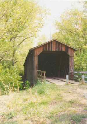
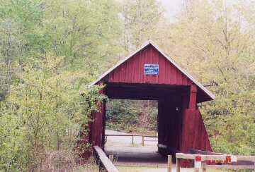
Finally we drove to the covered bridge. The sign said
that it was moved from Athens, Ga at a cost of $18,000. The WGCB says the move took place in
1965. I have included three photos of it. One was taken from the paddle wheel boat "Scarlet
O'Hara" on Stone Mountain Lake. It was a pleasant boat ride, with views of the covered
bridge and a carillon.
On Thursday we went to the Southeastern Railway
Museum, in nearby Duluth. There is a 12 minute train ride, and a large number of railroad cars
and engines. I have attached two scans, an engine and an engine wheel with Lisette.
On Friday, we will be heading home, via seven more
covered bridges in northern Georgia. So I found a local AAA office and got a more detailed map
of North Georgia. It shows three covered bridges, one of which, Kilgore's Mill, is not on the list
we have from the Georgia website. It turns out that it burned down, which we found out
after spending some time looking for it. When we got home, I checked the lost covered bridge
website and found it was destroyed in 1993.
Tom Keating
Duluth to Amicalola Falls State Park, Ga.
Wednesday, 5 May 2004
Hi Joe
On Friday morning, we left Norcross to find more
covered bridges. We decided to skip Lula covered bridge because the website directions say it is
private, owner does not give permission to enter, etc. Many of these bridges had signs telling
you where to turn. Liz says"Bless their heart!!"
We saw the Rockdale County (not historic, built
1997, no #), Elder's Mill, Watson's Mill--located in a very nice state park, Howard, and Cromer's
Mill covered bridges.
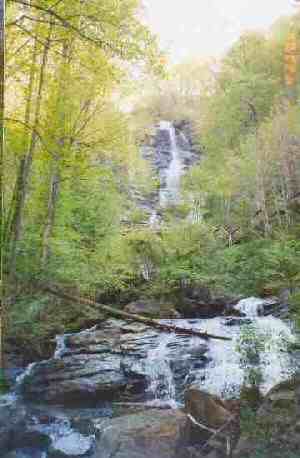
We stopped for the night in Dahlonega. In the
morning we went to Amicalola Falls State Park, which has a very pretty waterfall. There are
two pictures of the footbridge in front of the waterfall, One with telephoto lens. I am on the
footbridge in both pictures. Liz stopped when she saw the sign that "425 steps going up"
Tom Keating
Amicalola, Ga to Campbell's CB, SC
Thursday, 6 May 2004
Hi Joe
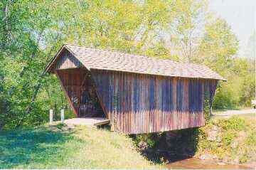
We left Amicalola Falls and drove to Stovall's Mill
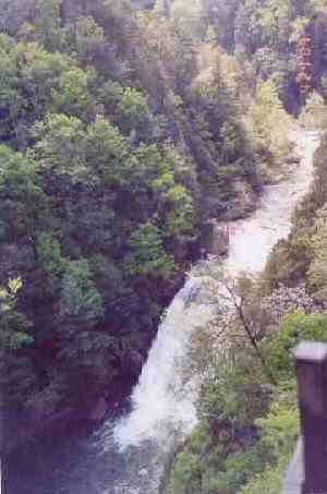
covered bridge(shown on that N. Ga. map from AAA). Then we went to Tallulah Gorge State
Park, Ga. The Tallulah Falls are quite pretty. There is a two-mile loop trail, with 425 steps going
down to a suspension footbridge. The visitor center clerk told us to continue on after crossing the
footbridge, rather than returning to go up the 425 steps. She didn't tell us that there were still
close to 300 steps going up after the footbridge. The suspension footbridge only swayed a little,
until five young, power walkers crossed from the other side. Then it vibrated like a drum.
We spent the night in Lavonia,Ga. On Sunday we
entered South Carolina on I-85, but got off at exit 1, to drive the Cherokee Foothills Parkway
(SC11). We got off the parkway to visit Stumphouse Mountain Park, which has Issaqueena Falls,
a 200 ft cascade. However the overlook is only about 150 ft. from the top of the falls and it is
impossible to get the whole falls in one picture. We used a map from the SC tourism office and
another map from www.upcountry.com which shows secondary roads (including the ones
needed to get to Campbell's covered bridge). The SC state map shows the Campbell bridge,
but not the secondary roads.
Next stop was Cowpens National Battlefield Park,
site of a Revolutionary War battle (1-17-1780) between US soldiers under Gen.
Daniel Morgan and British cavalry/dragoons under Colonel Banastre Tarleton, model for the chief
bad guy in the Mel Gibson movie "Patriot."
In the movie, Gibson kills the bad guy. In real life,
Tarleton went back to Britain, served in Parliament, became a member of Wellington's card
playing group, and died a peaceful death of old age. More info can be found in an excellent
book"Partisans and Redcoats" by Walter Edgar. Mr. Edgar spoke about his book on C-SPAN.
He commented that some British newspapers protested about the brutality in the movie "Patriot."
He said that, in fact, the movie toned down the British ruthless behavior. He further stated if the
combatants were judged by today's laws, Tarleton would be considered a war criminal. However,
he went to say that there was cruelty on both sides, with Loyalists/Tories and US soldiers burning
each others homes. Tarleton is notorious for the battle of Waxhaws, SC (5-29-1780), where his
dragoons attacked and overwhelmed about 400 Virginia patriots. They attempted to surrender.
Tarleton's men, following their leader's example, killed every last one.
US soldiers under Morgan defeated Tarleton's
dragoons at Cowpens. Tarleton escaped. Some US soldiers wanted to kill all the British soldiers,
crying "Tarleton's Quarters!" but US officers managed to stop this. Sorry no pictures from
Cowpens. There is a loop trail about 1.5 miles long with interpretive signs. There is also a well
done movie presentation of the battle, with a computerized map depiction of the battle.
One of the signs at Cowpens or Kings Mountain
Battlefield Parks quoted from a militia muster: "Five free men of colour" were in this battle.
Tom Keating
[Note: All pictures were taken by my wife, Lisette -
Tom]
Cowpens, SC to Western NY
Saturday, 8 May 2004
Hi Joe
We left Cowpens Park and drove back to the parkway
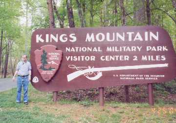
and then to I-85. We drove to NC, got off at exit 1, and took route 216 back to SC and Kings
Mtn National Battlefield Park(see scan of cool sign), considered by many historians to be the
turning point in the war in the south.
By 1780, the war was at a stalemate. England had
decided to re-establish the southern colonies, march north to join loyalist troops at Chesapeake
Bay, and claim the seaboard.
Major Patrick Ferguson, in command of the British at
Kings Mtn, was the only Briton who fought there, the rest of the soldiers were loyalists colonists
that Ferguson had recruited. Ferguson had about 1100 soldiers on Kings Mtn, a plateau about
600 yards long by 60 yards wide. There is a 1.5 mile loop paved trail that takes you to the top
of the plateau. About 1800 US soldiers were commanded by Colonel William Campbell, from
Virginia(I don't know if he was related to Campbell's bridge Campbell).
Ferguson had threatened to lay waste to the property
of all who did not join him. This enraged the "over the mountain men"(west of the
Appalachians) and they joined with men from the Carolinas and Virginia to defeat Ferguson once
and for all. This they did on Oct. 7, 1780. Ferguson refused to surrender and was killed.
Although Tarleton and his men were not present, cries of "Tarleton's Quarter" were heard when
the Loyalists tried to surrender. Ferguson's second in command, a Captain DePeyster, hoisted a
white flag and American officers were able to stop the killing and take about 800 men prisoner.
Captain DePeyster lost all his property and relocated
to New Brunswick(province in Canada with many covered bridges). Cornwallis had to give up
his plan of winning the war with soldiers recruited from the colonies. British General Clinton
called this defeat"the first link in a chain of evils that...ended in a total loss of America." Defeat
at Cowpens followed on 1-17-1781. Surrender at Yorktown and the end of combat came
10-19-1781(thanks to a French fleet blocking Cornwallis' escape via water).
The visitor center has an excellent movie with
re-enactors and maps showing the battle. Liz liked this movie better than the one at Cowpens.
We stopped in Gastonia,NC for the night.
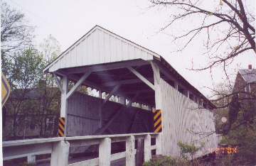
On Monday we drove to Hickory, NC to see the
Bunker Hill covered bridge, using directions from www.hickorymetro.com Unfortunately,
the bridge and Museum are only open W,F, and Sun.,9-4. The gate was closed and locked. We
parked in the driveway. Liz used a path around the gate to walk to the bridge while I waited in
the car, ready to speak to inquiring authorities if necessary. None came, and Liz got her picture
(see scan).
We drove to Beckley,WV., and stopped for the night.
On Monday we drove to Hawks Nest State Park,W.Va., on the New River gorge. The John
Marshall Tower was built here about 1839, in honor of a visit by Chief Justice of the US Supreme
Court, John Marshall, a native Virginian(this was part of the state of Virginia, then). It is now
used for rest rooms. We walked a couple of short trails and then drove on, stopping for lunch at a
Subway off I-79. While we were eating, someone backed into our parked car, and then came
inside and identified herself! Yes Virginia, there are honest people in the world!!
We stopped in Waynesburg, Greene County,Pa. for
the night. While in Waynesburg we drove to the White, Carmichael'ssee note,
Woods, Scott, Cox Farm(WGCB calls it Lippincott), and Shriver covered bridges
We used the Evans book and a Greene County map
from the Pa. Welcome Center( www.co.greene.pa.us ). The book had only the 1 mistake.
Kudos to the Evans for a fine book!! The King Br,Pa-38-30-24, was gone, only stone abutments
remained. King Sister Rd. was barricaded. We could see construction machinery and workers.
No clue as to what the new bridge will be like.
We arrived home on Weds., April 28, in plenty of
time for the Cystic Fibrosis Walkathon on May 15-16. For more info on this disease, go to
www.cff.org Liz incorporated all of her covered bridge photos into her cb scrapbook. She
gets her ideas from "Scrapbooking" a show on DIY, a cable tv channel.
Tom Keating
[Note--directions from "Pennsylvania's Covered Bridges" by Benjamin D. Evans and June R.
Evans are incorrect. On p.135, it says "In Carmichaels, at the intersection of E. George St. and
Vine St., go east on Vine St for 1 block to Market St. " Market St. runs off of E. George St
not Vine St. We found this out after driving up and down Vine St in both directions from the
intersection.]
|
|
| Kings Mountain National Park, NC
|
Bunker Hill Bridge NC-18-01
|
|
|
| White Bridge PA-30-30
|
Carmichael's Bridge PA-30-21
|
|
|
| Woods Bridge PA-30-26
|
Scott Bridge PA-30-28
|
|
|
| Cox Farm Bridge PA-30-21
|
Shiver Bridge PA-30-29
|
|
 Joe Nelson, P.O Box 267, Jericho, VT 05465-0267
This file posted May 9, 2004
Joe Nelson, P.O Box 267, Jericho, VT 05465-0267
This file posted May 9, 2004